EU-Rail was at the ERTMS 2026 Conference in Valenciennes, France, from 21 to 23 April 2026. Organised by the European...
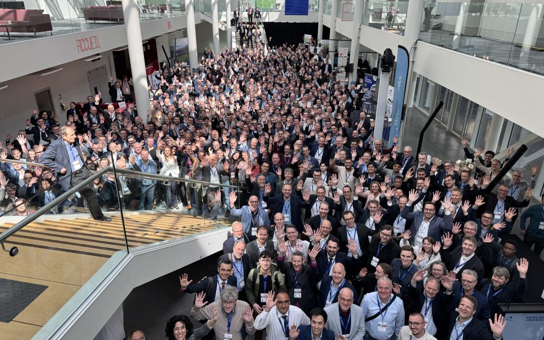
EU-Rail at the ERTMS 2026 Conference: Shaping the Future of European Rail
read more

A body of the
European Union

Access the list of all EU-Rail Calls for Proposals.

On 21 June 2024, the Governing Board of Europe’s Rail Joint Undertaking (EU-Rail) adopted a Call for Expression of Interest (CEI) with a view to selecting associated members with the potential to contribute to the achievement of its objectives. The Governing Board decision can be accessed here.
Discover detailed information about procurment rules and information.
Access detailed information about past tenders.

Europe's Rail regularly published Calls for Tenders. To find out about open Calls, follow link below.

Article 15 (Principle of transparency) of the EU-Rail financial rules states that the JU shall make available on its internet site no later than 30 June of the following financial year information on the recipients of funds deriving from its budget.

EU-Rail’s Innovation Pillar (IP) is tasked to deliver operational and technological solutions that contribute to a more efficient, flexible, and demand-led, yet safe and environmentally sustainable European railway system.

The System Pillar provides governance, resource, and outputs to support a coherent and coordinated approach to the evolution of the rail system and the development of the system view.

The Deployment Group advises the EU-Rail Governing Board on the market uptake of rail innovation developments and support their deployment.
For a successful and effective implementation of the Digital Automatic Coupler for European rail freight (DAC), it is of crucial importance to have open, close and efficient cooperation between rail stakeholders. The European DAC Delivery Programme enabled by Europe’s Rail, offers a unique European platform for such cooperation and collaboration.
Discover how Europe’s Rail Joint Undertaking is calling for a bold, coordinated investment strategy to simplify and modernise rail systems across the EU. This public-private partnership model – outlined in our High-Level Paper – proposes an €18 billion investment from 2028 to 2034 to strengthen European competitiveness, deliver greener transport, and drive technological sovereignty.

The Shift2Rail Joint Undertaking is the predecessor programme of the Europe's Rail Joint Undertaking (EU-Rail), established by Council Regulation (EU) 2021/2085 of 19 November 2021.

Discover detailed information on Europe's rail innovation initiatives, showcasing flagship and other projects aimed at enhancing rail systems across Europe. It highlights collaborative efforts funded by the European Union to develop sustainable, efficient, and competitive rail transport solutions.

Europe’s Rail Catalogue of Solutions illustrates successful R&I results in the form of possible products and solutions, while highlighting the benefits for final users, operators, infrastructure managers and/or suppliers. This publication also outlines the advantages of integrating demonstrators into market solutions so that they can deliver the rail innovation Capabilities of the future.
Europe’s Rail Joint Undertaking (EU-Rail) is the European partnership on rail research and innovation established under the Horizon Europe programme (2020-2027) and the universal successor of the Shift2Rail Joint Undertaking.

Find out the full list of Europe's Rail Members.

Discover the full structure and governance of Europe's Rail, including the decisions of the Governing Board.

Get access to Europe's Rail main reference documents, including Annual Work Plans, Annual Activity Reports, Annual Accounts and other important information.

To achieve even greater accuracy and real-time localisation of trains by improving onboard positioning technology – using Global Navigation Satellite Systems (GNSS), such as the EU’s Galileo.

Shift2Rail delivered six Technical Demonstrators, defining an interoperable solution for Satellite-Based FailSafe Train Positioning (FSTP) that brings together:
1. Virtual Balises (VB);
2. a Stand-Alone FSTP system.
Researchers produced a Roadmap and Migration Strategy exploring:
How does it work?
Positioning information is sent to a train through GNSS signals, supported by extra sensors, instead of relying only on physical balises along the track
An onboard Virtual Balise Reader processes the GNSS signals and compares the GNSS coordinates with the list of coordinates onboard
The reader reports the corresponding virtual balise to the Eurocab (a train-based computer), when the coordinates stored for it are reached
5 (technology validated in a relevant environment)
5 (technology validated in a relevant environment)
4 (technology validated in a lab)
Incorporating track data into the onboard algorithm can be a crucial factor in enhancing safety and
accuracy
Integration of satellite technology with standard positioning systems proved feasible, supporting:
Implemented algorithm robust enough to cope with environmental disturbances to train positioning. Further runs on different lines are still necessary
Showed feasibility of a positioning system of around 20 metres fixed error
Can result in error values below 3 metres
Challenging GNSS conditions affected precision of speed estimates

Calling on highly accurate real-time information from Virtual Balises on trains, supported by other sensors and technologies, these innovations can: